Horizen — Excellence Through Quality← All capabilities

FIELD SURVEY · DGPS · DRONE · CAD

Engineering information starts with field reality.

Horizen’s in-house survey team collects primary infrastructure data and carries it into GIS, engineering drawings and model-ready network information.

Explore the capability ↓
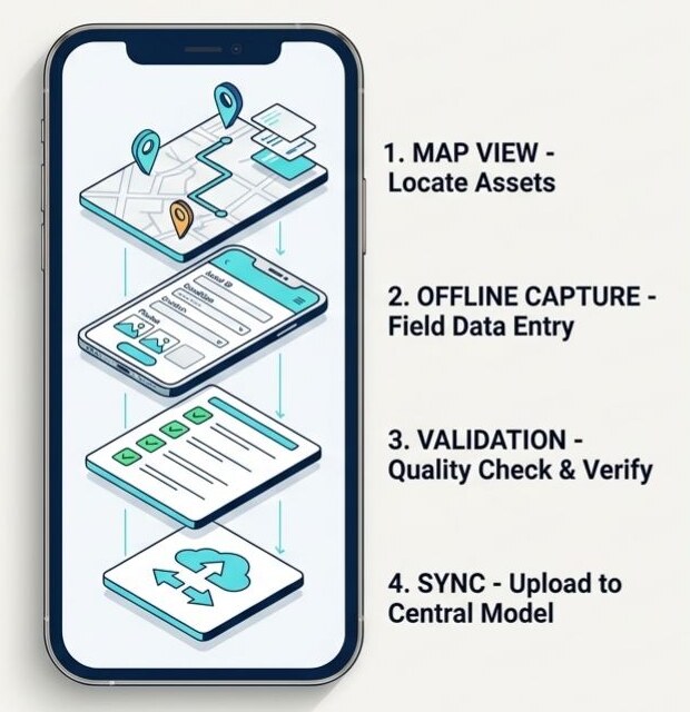
Generalised survey-to-digital-record workflow from the Horizen blueprint
Horizen blueprint · Generalised capability illustration

Survey & engineering

What the capability covers

Field survey, DGPS, drone outputs and ground verification support asset and alignment mapping. GIS/CAD integration connects survey records with pipeline drawings, as-built documentation and water-infrastructure planning.

01

Primary survey

In-house field collection, network and alignment surveys, asset observations and ground truthing.

02

DGPS & drone mapping

Survey and mapping inputs for geographic positioning and infrastructure documentation, with methods selected for the project scope.

03

CAD & as-built drawings

AutoCAD pipeline drawings, network alignment, asset details and pipe information including material, diameter and length tables.

04

GIS & model preparation

Survey-to-GIS conversion and CAD/GIS integration for WebGIS and hydraulic-model development.

05

Water-infrastructure DPR

Detailed project reporting for water infrastructure, rising mains and distribution networks, connecting survey, planning and engineering documentation.

CONNECTED DELIVERY

How the work moves forward

01

Survey

Collect alignment, asset and primary field information.

02

Verify

Review observations and reconcile field records.

03

Document

Prepare GIS datasets and engineering drawings.

04

Apply

Support DPRs, network modelling and engineering review.

OUTPUTS

Information ready for use

  • Field-verified asset and alignment datasets
  • GIS/CAD network information
  • Pipeline and as-built drawings
  • Engineering tables and digital documentation
  • Water-infrastructure project reports

ILLUSTRATIVE WORKFLOW · NOT A CLIENT CASE STUDY

From surveyed alignment to engineering review

A network survey is checked and structured into GIS and CAD. The resulting alignment, asset details and pipe information support drawing preparation and provide an evidence base for subsequent hydraulic assessment or project reporting.

Connected capabilities

Discuss your infrastructure requirements →